We create cost-effective digital twins of buildings and sites using drones, giving detailed 3D models for planning, inspections, and progress tracking—even in hard-to-reach areas—while also providing stunning visuals for marketing.
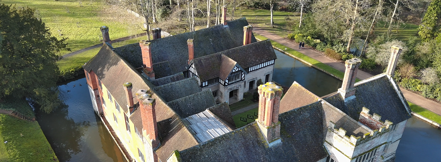
Creating a Digital Twin, 3D model, or point cloud of a building, construction site, or even a large housing estate offers huge benefits for planning, inspections, and project management.
We use specialist drones and RTK networks to capture data with centimetre-level accuracy, ensuring that users can measure and analyze the building without ever leaving their desk. These models and point clouds can be imported into CAD or Revit and converted for BIM, giving architects, engineers, and facility managers a powerful tool to streamline workflows.
High detail. High accuracy. Low cost.
✅HOUSING ASSOCIATIONS Digital twins of high-rise or complex buildings allow you to inspect walls, windows, cladding, and roofs remotely. These models can be made available online and integrated into your BIM solution, helping manage multiple properties efficiently.
✅NATIONAL TRUST AND HERITAGE SITES Heritage buildings often feature complex roofs and inaccessible areas. Our drones can capture detailed 3D models, videos, and photos of these hard-to-reach spaces, providing high-quality data for planning, conservation, or restoration work.
✅ROOFING, CLADDING AND SOLAR PARNELS Need accurate roof measurements before scaffolding goes up? We create precise 3D models and provide detailed aerial videos and photos so you can plan and inspect works remotely. Results are delivered directly to your inbox.
✅LAND AND MAPPING We map and measure land before construction begins, creating online models that can be shared with teams. Architects can overlay CAD drawings on the model to visualize completed projects—all with centimetre-level precision.
✅COUNCILS AND PLANNING Drones can efficiently map large-scale areas for conservation, planning applications, or boundary assessments. High-detail, high-accuracy models help councils and planners make informed decisions quickly and cost-effectively.
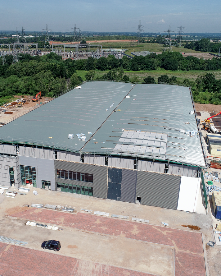
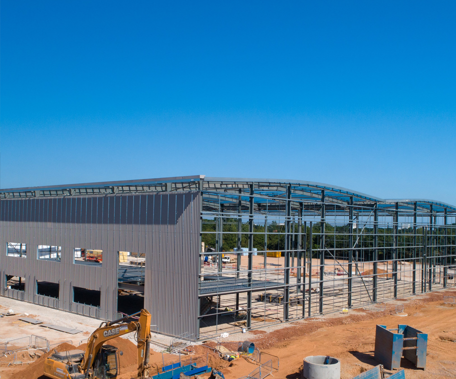
Our experienced team begins every project with a full risk assessment of the site and surrounding airspace to ensure safety and compliance. Once the area is cleared, we deploy specialist drones to capture all the data required—from high-resolution aerial photography to precise measurements using RTK technology for centimetre-level accuracy.
Back in the studio, we process this data using specialist photogrammetry and 3D modelling software to create a highly detailed, accurate digital twin of your building, site, or land area. This model can then be hosted online, making it accessible anytime, anywhere. Teams can zoom in on specific details, take measurements, or integrate the data into CAD, Revit, or BIM workflows—without needing to revisit the site.
The result is a safe, cost-effective, and powerful way to view, inspect, and share your project in full detail.


The benefits of Digital Twins for your company


Customers
reviews
Mark seamlessly navigated complex aerial projects, capturing valuable footage and delivering precise data for our needs. His attention to detail and meticulous approach ensured that every aspect of the project was executed flawlessly.

Mark has been an invaluable asset to our team, consistently delivering exceptional results and demonstrating a genuine passion for his craft. We look forward to continuing our partnership with him for all our future aerial endeavours.