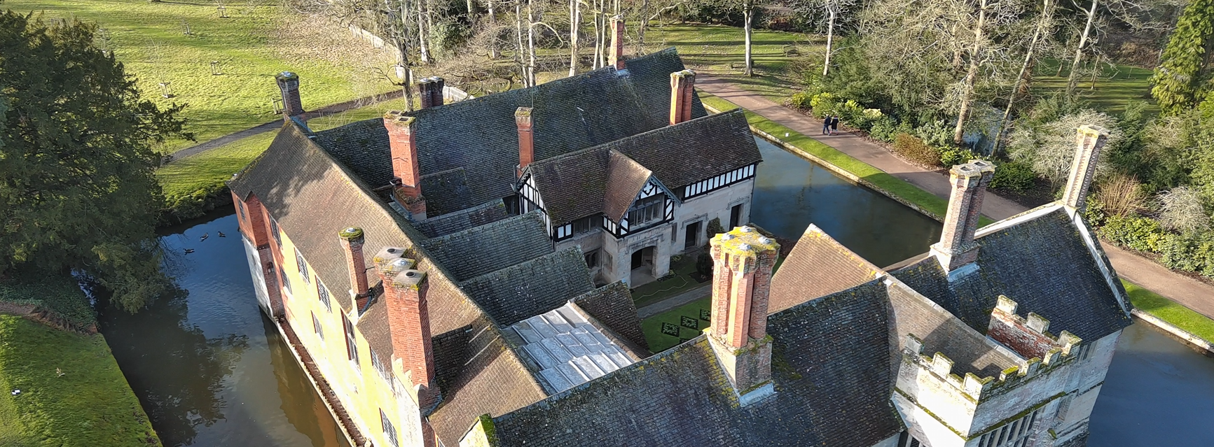
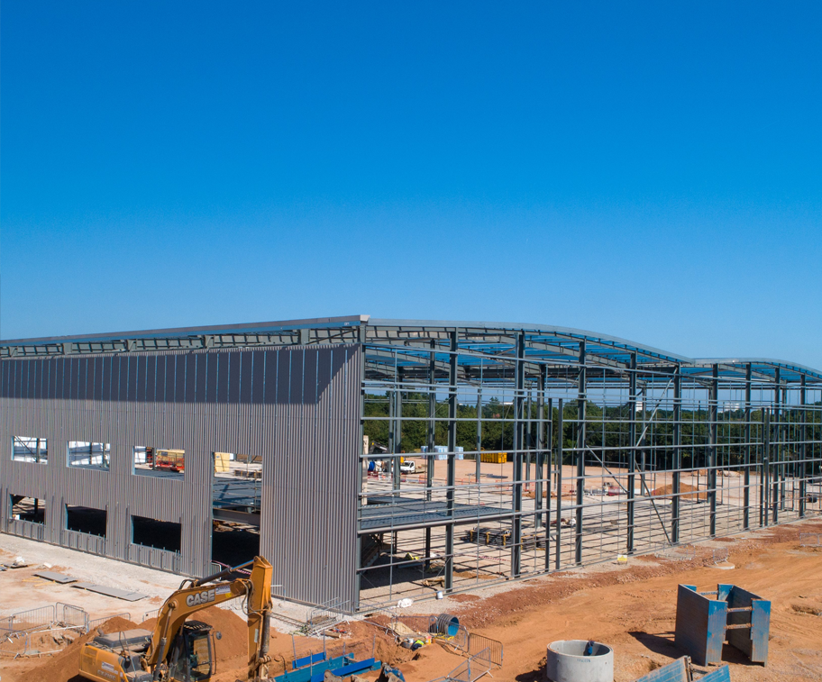
Drone mapping uses high-resolution aerial imagery and GPS data to create precise, detailed maps and 3D models of land, buildings, and structures. By flying automated routes, drones can capture hundreds of overlapping images that are processed into measurable maps — far faster and more safely than traditional surveying methods.
Creating a Digital Twin, 3D model, or point cloud of a building, construction site, or even a large housing estate offers huge benefits for planning, inspections, and project management.
High detail. High accuracy. Low cost.
✅High Accuracy At Mark Zaccaria Photography & Drone Services, precision is everything. Our drone mapping and inspection work uses advanced GPS positioning and high-resolution imaging to deliver centimetre-level accuracy. Whether you’re surveying land, inspecting roofs, or planning a construction project, you’ll receive detailed, reliable data you can trust to make informed decisions.
✅Safety Safety is at the heart of every project we carry out. Using drones eliminates the need for ladders, scaffolding, or working at height, drastically reducing risk on-site. We hold full CAA authorisations and insurance, so every flight is completed to professional and regulatory standards — keeping both people and property protected at all times.
✅Speed & Efficiency Our drone and photography services are designed to save you time without compromising quality. Large sites or multiple inspection points can be captured in minutes rather than days, with fast image turnaround and precise post-processing. The result is a streamlined workflow that keeps your projects moving efficiently from start to finish.
✅Cost-Effective By replacing traditional surveying or access methods with drone technology, we help you cut costs on equipment, labour, and downtime. You only pay for the data and imagery you need, delivered quickly and professionally. It’s a smart investment that gives you clear, measurable value on every project.
✅Visual Insight We don’t just capture data — we create clarity. Our drone imagery and 3D mapping visualisations provide a clear, easy-to-understand view of your site or structure. Combined with our photography expertise, we turn technical information into visually engaging content that supports reports, presentations, and marketing materials alike.

Our experienced team begins every project with a full risk assessment of the site and surrounding airspace to ensure safety and compliance. Once the area is cleared, we deploy specialist drones to capture all the data required—from high-resolution aerial photography to precise measurements using RTK technology for centimetre-level accuracy.
Back in the studio, we process this data using specialist photogrammetry and 3D modelling software to create a highly detailed, accurate digital twin of your building, site, or land area. This model can then be hosted online, making it accessible anytime, anywhere. Teams can zoom in on specific details, take measurements, or integrate the data into CAD, Revit, or BIM workflows—without needing to revisit the site.
The result is a safe, cost-effective, and powerful way to view, inspect, and share your project in full detail.


The benefits of Digital Twins for your company


Customers
reviews
Mark seamlessly navigated complex aerial projects, capturing valuable footage and delivering precise data for our needs. His attention to detail and meticulous approach ensured that every aspect of the project was executed flawlessly.

Mark has been an invaluable asset to our team, consistently delivering exceptional results and demonstrating a genuine passion for his craft. We look forward to continuing our partnership with him for all our future aerial endeavours.